Chapter 6: Landscape & Seascape Character
This chapter is largely derived from other official sources. It describes the character of defined landscape types, the condition of the landscape and the coastal and seascape character.
At a national level, England is divided into 159 National Character Areas (NCAs), large areas that share similar landscape characteristics. The Dorset National Landscape covers NCAs 136 South Purbeck and 139 Marshwood and Powerstock Vales in their entirety, and a significant area of 134 Dorset Downs and Cranborne Chase and 138 Weymouth Lowlands. Towards the boundary, the designation overlaps smaller areas of 133 Blackmoor Vale and the Vale of Wardour, 135 Dorset Heaths, 140 Yeovil Scarplands and 147 Blackdowns.
Natural England has authored the NCA profiles; each has a description of the natural and cultural features that shape the landscape and outline the ecosystem services it provides and the key drivers for change. These inform Statements of Environmental Opportunity (SEOs) designed to achieve sustainable growth and a more secure environmental future. The NCA profiles can be viewed at Natural England – National Character Area Profiles – National Character Area Profiles
A Landscape Character Assessment (LCA) for the Dorset National Landscape – Conserving Character – was published in 2008 and revised in 2018 Landscape Character Assessment | Dorset National Landscape. The Dorset Coast Landscape & Seascape Character Assessment (LSCA) was published in September 2010 Land-and_Seascape_Character_Assessment.pdf.
These documents provide an understanding of:
• The qualities and features that make the landscape/seascape special
• How these features combine in different ways in different places to give each area its own unique character
• The strength and condition of these features and how they are changing.
The character assessments for Dorset National Landscape sit alongside and geographically overlap with other assessments, such as those that exist at a county-wide level and the suite of National Character Area (NCA) profiles for England. Consequently, there is some overlap between the content of these broader studies, such as the NCA’s statements of environmental opportunities, and out LCA work. Overall, our character assessments offer a finer level of granularity in terms of the character areas that they describe.
In this section we have summarised the key characteristics of the different landscape and seascape types. This provides a spatial framework for management of the National Landscape.
The Dorset National Landscape’s LCA identifies 14 landscape types, such as open chalk downland, clay vales, limestone hills and rolling wooded pasture. These landscape types share common combinations of geology, topography, vegetation and human influence but are not specific to a particular location. The LCA breaks these landscape types into individual and unique geographical areas called landscape character areas, such as the Upper Piddle Valley or Marshwood Vale. The assessment identifies 35 landscape character areas in the National Landscape.
The character and quality of the land and sea interface is an important aspect of the National Landscape, however the coastline is constantly changing, subject to powerful coastal and hydrological processes. The Dorset Coast Landscape and Seascape Assessment is a valuable tool, promoting an integrated approach to decision making in this transitional area. The assessment reflects the terrestrial landscape character types identified in Conserving Character, plus it identifies 11 seascape character types of coast and sea.
It is important to identify and recognise the landscape and seascape character types/areas that lie outside the National Landscape boundary as they contribute to the setting of the area.
The following descriptions give a summary of the character or the key characteristics of the landscape and the seascape types that are within or contiguous with the National Landscape boundary.

The open chalk uplands of the Chaldon Downs, Dorchester Downs and South Dorset Downs form significant areas of the designated area. They are the National Landscape’s largest-scale landscapes of simple, rolling open hills and dry valleys with large agricultural estates mainly under arable production. Partly circled by a narrow face of steep escarpments, the open uplands provide the setting for a series of intimate chalk river valleys. There are strong cultural associations with Thomas Hardy.
The North, West and South Escarpments and the Purbeck Ridge form dramatic backdrops to, and give views of, much of the surrounding National Landscape. With an undeveloped and open character, this landscape type with its steep sides supports important patches of chalk grasslands and hanging woodlands.
The distinctive, secluded chalk valleys of the National Landscape drain the surrounding open chalk downlands. Flowing southwards into the larger Stour, Piddle and Frome rivers, each valley has its own unique character and sense of place, with a diversity of important habitats and cultural features.
With traces of old water meadows, distinctive church spires, country houses and characteristic settlements of stone, brick and flint, the chalk valleys display a rich rural cultural heritage.
The sweeping landscapes of the Kimmeridge Coast, Corfe, and Bride Valleys each have a unique identity. Enclosed by surrounding escarpments and ridges, they generally have a settled rural character with coastal influences. A patchwork of rolling pastures and scattered woodlands have been shaped by centuries of woodland clearance and agricultural improvement. Small farmsteads and nucleated villages with landmark churches are dotted throughout the landscape.
The internationally important lowland heathland landscape of the South Purbeck Heaths, similar to many other heathland landscapes around the Poole Basin, is a complex and diverse mosaic of open dry and wet heath and wooded scrubby heath. A range of land uses affect condition, with the fragile heaths under constant pressures. Remaining heathland patches, many of which are internationally important habitats, are fragmented by significant conifer plantations, with a variety of land uses including mineral extraction and planned farms.
The valley pasture landscape type is found along the Rivers Stour and Frome, formed from alluvial deposits. They have wide, open meandering floodplains that historically support transport routes and market towns around the fringes. A series of wet woodlands, large pastures and water meadows are typical of this landscape type.
The Purbeck Plateau is the only limestone plateau in Dorset. It has a simple but striking character represented by its exposed and treeless appearance. A long tradition of stone extraction has left its mark, shaping a near continuous network of stone walls, extraction routes and small quarries dotted across the area. Limestone villages and open grasslands add to the character of this distinct landscape type.
The ridge and vale landscape type covers two character areas to the east and west of Weymouth. Backed by the South Dorset Escarpment, these types are characterised by low lying limestone ridges running east to west, with undulating clay vales of mixed farming and nucleated villages.
The rolling wooded pasture landscape type is found around the margins of the Dorset Heaths. Although land cover varies, the areas are unified by remnant heathy patches within a well wooded landscape of pastures and dense hedgerows, shaping an intimate and rural landscape. Rempstone has a more agricultural character; towards Lulworth the area has strong parkland character.
Coastal grasslands, as a habitat, are found along much of the immediate coastline. It becomes a landscape type where the characteristic coarse grasses, exposed by the full force of the coast, are backed by the southern escarpment and divide it from the inland landscapes. A lack of development and the sweeping coastal views underpin a natural appearance.
The clay vale landscape type is represented by the intimate and rural Marshwood, Halstock and Blackmore Vales. They have predominantly small pastoral fields with trimmed hedgerows and hedgerow oaks, patterns of medieval settlement and clearance and a long tradition of dairy farming. Scattered farmsteads underpin the largely undeveloped and tranquil character.
Significant areas of the western extent of the National Landscape form the intimate wooded hills landscape type, with several clusters of conical shaped hills formed around the Marshwood Vale. Typically, woodland is found on the valley sides with a network of dense hedgerows, holloways, winding lanes and small clustered settlements dotted throughout the pastoral landscape. The market and coastal towns in and around the area support a long tradition of artistic interpretation of the landscape and local cultural traditions.
Although found elsewhere around the northern part of the county, the only limestone hill landscape within the National Landscape is found at Melbury Park. Much of the area is dominated by the designed parkland at Melbury with its distinctive, sweeping landscape. Elsewhere, a series of low, rounded limestone hills with dense wooded sides contrast to the broad, clay valleys of pastures, arable fields, winding lanes and springs.
The undulating river valleys of the Brit and Axe are centred on the floodplains and associated surrounding branching valleys and undulating hills. They have a diverse character ranging from open countryside to market towns and villages dotted along the upper terraces. Characteristic features include damp pastures, linear wet woodlands along the valley floor with small broadleaved woodlands dotted around the surrounding hills.
Each landscape character area has been assessed in 2018 for its condition and the direction of travel. This assessment helps to prioritise action geographically. More detail can be found in the Dorset National Landscape LCA.
Application of the Management and Planning Guidelines for each character type in the LCA will help address character weaknesses and reverse declining quality.

These predominantly sandy beaches are generally not associated with extensive sand dune systems, except at Studland. They are important recreational beaches, have warm sea temperatures and are important for marine and coastal biodiversity. Coastal defences are present on some beaches.
Chesil Beach is an impressive example of this type due to its height and extent and is a unique feature on the Dorset coast. These areas have large, often raised shingle beaches and spits. Dominated by shingle, the grain size varies from very fine to large shingle and sometimes mixed with sand. They are often important for protection of cliff bases.
These are softer rock cliffs, susceptible to erosion and landslips although may be stable for long periods. The softer substrate provides habitat for colonisation of cliffs with vegetation over time. Beaches, usually shingle, protect cliff bases. Significant fossils are often present and they are an important cliff type within the Jurassic Coast World Heritage Site.
These hard cliffs are variously made of sandstone, chalk or limestone with vertical or near vertical faces and ledges. They are often dramatic, with pinnacles and pillars, and are often highly visible from long distances – conversely, they also provide significant panoramic viewpoints. They are generally un-vegetated with ledges important for nesting seabirds. While still mobile, in comparison to the slumped cliffs seascape type they are more stable and resistant to erosion. They are also an important cliff type within the Jurassic Coast World Heritage Site.
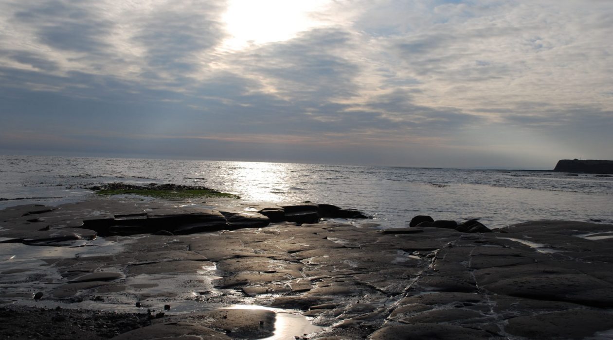
These horizontal rock ledges within the intertidal zone include loose rocks and boulders and experience varying levels of inundation depending on tides and location. They often include important intertidal habitats and are frequently in remote, inaccessible locations.
This is the type for Poole Harbour (the world’s largest natural harbour), the majority of which lies within the National Landscape boundary. With a distinctive mix of tidal mudflats, marshland, reed bed, open water and shingle bank it has indented and shallow shorelines to the harbour which resemble large lakes. Characterised by a large scale, open, tranquil and generally unspoilt landscape it is of significant conservation value and offers important vistas and views of historic and cultural importance.
The Fleet is the tidal water impounded by Chesil Bank; open to the sea through Portland Harbour. Described as the finest example of a lagoon of its type, it includes a distinctive mix of tidal mudflats, marshland, reed bed, open water and shingle bank, has an indented and shallow shoreline and is of a large scale: open, tranquil and generally unspoilt. As with Poole Harbour, it is internationally important for wildlife and has important vistas and views of historic and cultural importance particularly related to Abbotsbury and the ancient Swannery.